About Me

My photo
Hello! My name is Keith Gault and I've been tramping the hills of the UK and further afield for over 40 years now. This blog records some recent hill days undertaken either on my own, with friends, or with clients under my guided hillwalking Company: Hillways (www.hillways.co.uk). I hope you enjoy my diary; please feel free to comment on any of the walks. I will respond to any direct questions.

Saturday 25 May 2013

Some Speyside Hills


Carn Dearg

As T S Elliot once wrote: “A cold coming we had of it”!  The green shoots of spring we started to witness in Braemar the previous week were well and truly snuffed out once we moved across to Aviemore.   A week of sustained cold northerly winds and heavy snow showers denied us the high tops of the Northern Cairngorms and forced a rethink. 

As snow showers turned into blizzards and yet more snow started to settle on the big hills, we turned our attention to some slightly lower peaks in the area and did what we could on the few days we could safely venture out during the week.  Only once, and then only briefly, did we feel any warmth from the sun.


Geal Charn

Geal Charn

Despite all the above, our first day produced what became a very warm, sunny afternoon - not only the warmest day of the trip, but also the warmest day of the month!  We selected one of the many Geal Charns in the Highlands.  This particular one sits quietly out of sight on the southern fringe of the Monadh Liath above upper Speyside.

We parked by the Spey Dam and made our way around countless signs, wire fences and gates all too loudly and unsubtly proclaiming a major water treatment construction site.  Lovely!  It was a relief to get away up Glen Markie and into the hills.  We searched in vain for a safe crossing point on the busy Markie Burn and had to move well up the glen before we found one.


A Distant Geal Charn From Carn Dearg

Once over the water, it was a heather plod on to the shoulder of Bruach nam Biodag after which the cloud and mist finally started to clear and we finally caught sight of our peak.  Heather gave way to grass and the last 2Km to the summit were quite pleasant as we followed the ubiquitous line of fence posts to the large cairn that marks the summit of Geal Charn (926m; white hill).

The return route was almost identical to our way in, the exception being the replacement of overcast gloom with increasingly bright sunshine and rapidly climbing temperatures.  It was to be the only warmth we felt on the whole trip.  Approaching the construction site, we suddenly saw a sparrowhawk swoop low across an adjacent field in an only-just-in-vain attempt to take a meadow pipit.  It failed at the first attempt and mobbing gulls ensured it didn’t get another chance!           


Coire Garbhlach Above Glen Feshie

Glen Feshie

Our second hill-day of the week saw us parking at the new Achlean car park in Glen Feshie and taking the familiar path up on to the Moine Mhor (great moss).  This path always was an easy climb, but recent – and much appreciated – renovation work has turned it into one of the best mountain footpaths in Scotland.  Before you know it, you are above 1000m and the majority of your climbing for the day is behind you!  That said, having entered cloud a little way above the car park, we didn’t actually see anything until we were descending late in the day.


A Distant Mullach Clach a' Bhlair Beyond Coire Garbhlach

As if to compensate for the perpetual 20m visibility, we were treated to the sight of 2 dotterel as we approached the plateau.  We had looked long and hard for these birds during the previous week but it had taken until now to finally catch sight of them.  The female lays the eggs and then buggers off in search of pastures (and other dotterel) new, leaving the man to raise the young.  It will never catch on.....  


Dotterel

The photo’s a little grainy, but poor light, low visibility and thick mist tend to make stunning wildlife photography somewhat difficult to achieve!


Sgor Gaoith

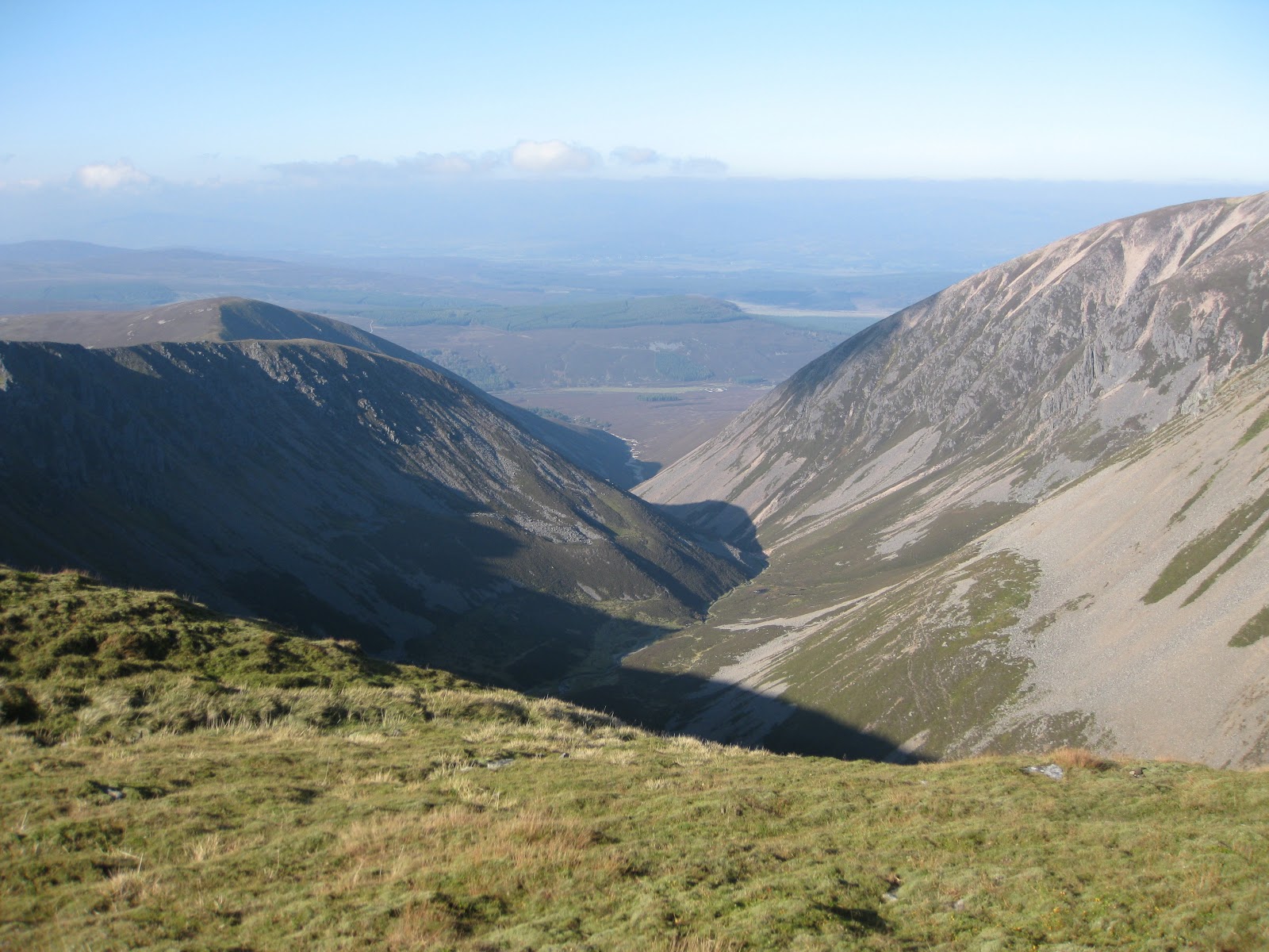
Once on the plateau, it was several hours of follow my leader in the mist, first to Mullach Clach a’ Bhlair (1019m; summit of the stone of the plain) and then backtracking before heading north to capture Sgor Gaoith (1118m; windy peak).  Neither peak gave us a view; neither tempted us to linger on their summits and neither was seen in their best light.  These photos from a previous trip give an idea of what you get to see on a good day!


Einich Cairn & Loch Einich From Sgor Gaoith

We finally cleared the cloud at about 800m in the descent but the dotterel were gone and so was the prospect of any sun. 

Monadh Liath – The Newtonmore Hills


A' Chailleach

One final day offered the chance to comple the Munros of the Monadh Liath (grey mountains) above Newtonmore.  We parked in Glen Banchor and headed north alongside the Allt a’ Chaorainn for 1½Km.  A small cairn marks the spot where you leave the track, turning sharp left and descending to cross the burn by what is now a dilapidated bridge. 


 A' Chailleach From Glen Banchor

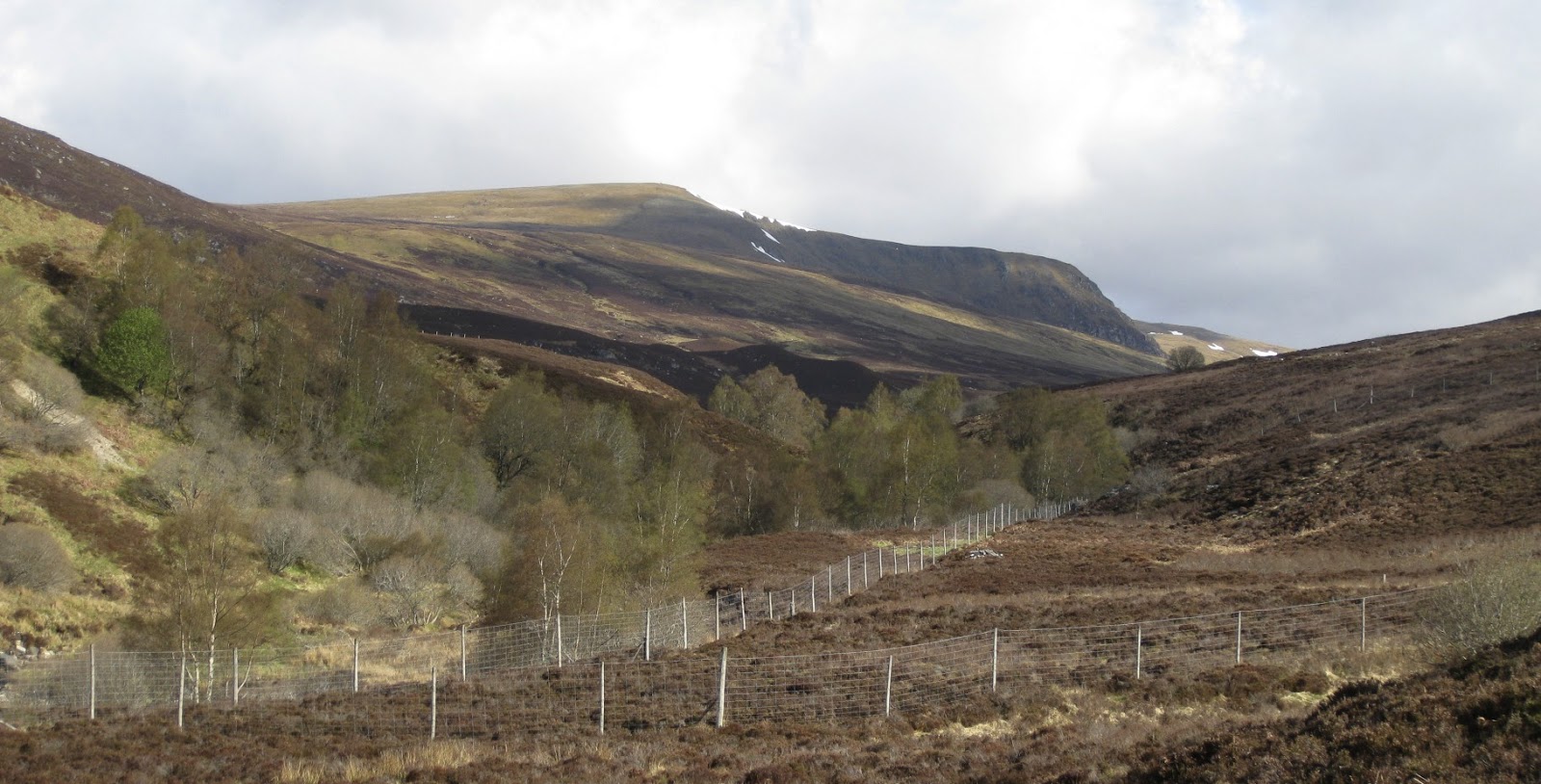
An intermittent path leads up easy slopes through the heather and past the Red Bothy on the slopes of An Leitir to grassier slopes higher up where a clear path leads straight to the summit of A’ Chailleach (930m; the old woman).  It had been a clear, sunny morning thus far but the view north we now had revealed the first of the heavy winter showers that were to plague us for the rest of our day.


A' Chailleach From Carn Sgulain

We descended quickly into the narrow glacial trough that separates A’ Chailleach from the surrounding peaks and took advantage of the last sheltered spot of the day to have our only real break of the day.  Then it was up the other side, across some peat hags to intercept yet more old fence posts and on to the flat summit of Carn Sgulain (920m; hill of the basket).


The Summit of Carn Dearg

All we had to do now was turn around and follow the fence posts over several km of almost flat grass, moss and stones to our 3rd Munro of the day.  This is easy on a good day, but it wasn’t much fun being constantly battered by gusty, heavy snow showers as a steady stream of hurt tried to halt our progress.  Of the intermediate tops, only the last one, Carn Ban (white hill), proved problematical as the snow really took hold and the stony false summits sapped our strength.  Eventually though, we sighted the summit cairn and there was Carn Dearg, our last Munro of the day, just a short way across a shallow bealach.  The showers stopped too, which gave us both respite and good views as we claimed our prize: Carn Dearg (945m; red hill).


Carn Dearg

The walk-out started well, but became a bit of a prolonged drag in the peat and rough heather of upper Gleann Ballach.  Eventually though, we made it to the wee bridge across the Allt Fionndrigh which we followed back down into Glen Banchor. 


Glen Banchor

So, not the most productive week, but given the previous week’s impressive Munro tally and the vengeful return of winter in mid-May, there was every reason to be pleased with ourselves.  Well done to Jennifer for battling the elements and finishing the trip with a creditable overall Munro count of 70.  She’ll soon be finished at this rate!  One way or the other... 


Check out my plans for the coming season at: http://www.hillways.co.uk/summer/summer.htm

Saturday 18 May 2013

Southern Cairngorms


Lochnagar

The past week has seen yet a further delay in the arrival of Spring in the Scottish mountains.  Based in Braemar, together with Jennifer, Jonathan and Matt, we still managed to tramp a few miles and climb a few hills, albeit to the general accompaniment of cold northerly winds and the odd wintery shower.  That said, all but 3 of the summits were clear on top and we were rarely soaked for any length of time.  The main feature was the lack of colour and natural life in the countryside – both flora and fauna.  The insects haven’t really got going yet and this has delayed the arrival of the summer migrants which are normally such a part of the hills in May.


The Glenshee Hills – East

There are plenty of hills in this part of the world and not many ‘easy’ days to choose from.  Accordingly, we offset a 6-Munro, 28km day with a high start from the Glenshee ski centre intent on traversing those Munros between the A93 and the Lochnagar massif.  These hills form the southern part of the White Mounth, from the Gaelic name for these uplands – Am Monadh Geal.


Creag Leacach

First up, we walked up the ski access track that leads over Meall Odhar (922m) and around the SW flanks of Glas Maol to the quartzite-bouldered ridge crowned by our first Munro of the week: Creag Leacach (987m; slabby rock).  Fence posts and a dry stane dyke lead the way so navigation is not really a problem.  Alternatively today, you could just have followed the group from the Blairgowrie & District Walking Club who were celebrating 35yrs in the business by putting 35 members above 3,500’!   As you might expect, this southern outpost of the Grampians affords great views southwards on a good day and we could clearly identify the Sidlaw Hills, the Lomonds and the Ochills.  This was Munro No 50 for Jennifer.  Again….


Glas Maol From Creag Leacach

Returning the same way, we passed all 35 of the Blairgowrie walkers before climbing the easy grass slopes that lead to the flat summit of Glas Maol (1068m; grey-green hill).  From here, most of the remainder of our day came into view, a sobering sight and one that suggested not hanging around!  A pause for some lunch out of the wind, and then it was onwards, along one of the vehicle tracks that criss-cross the Mounth hereabouts before climbing easily on to summit No 3 for today: Cairn of Claise (1064m; hill of the hollow).  This was Matt’s 30th Munro although he conspicuously failed to produce the expected whisky flask for a celebratory dram!  By this time we had seen about a dozen mountain hares and a handful of ptarmigan and were about to hear our first golden plover.  Unbeknown to us, we were about to see precious little else for the remainder of the day!


Cairn of Claise From Meall Odhar

The cloud rolled in part-way across our boggy traverse eastwards over to Tom Buidhe (957m; yellow hill) and it was to stay with us, together with occasional snow showers, until we were almost in sight of the car.  We also encountered our first snowfields approaching Tom Buidhe - not generally a problem now, but they could be tricky where they covered deep ditches and fast-flowing burns.


A Distant Tom Buidhe & Tolmount From Carn an t-Sagairt Mor

We wasted no time acknowledging our 4th Munro of the day and descended around the generally boggy wasteland that separates Tom Buidhe from its near neighbour, Tolmount (958m;  hill of the valley).  Again, we saw little and lingered even less before retracing our steps in increasingly dreich conditions around the head of Glen Callater.  We continued across open country over numerous soft snowfields before locating the wide bealach that led to our 6th and final Munro of the day: Carn an Tuirc (1019m; hill of the wide boar).  There were no pigs around today (not that we would have seen them), just a false summit that prompted premature celebrations amongst some of the party before the real thing finally loomed out of the murk and we could all celebrate!


Carn an Tuirc

From previous trips, I knew it was fairly easy to find a way through and around the quartzite boulder fields that cover the upper part of the mountain (the trick is to head SE initially from the summit before turning and descending to the W).  Eventually, the cloud started clearing revealing the glen below and a distant A93 that would lead us to where we all wanted to be – indoors!

 The Glenshee Hills – West


Carn Aosda From the West

In view of the previous day’s efforts and a less than favourable weather forecast, we opted for as easy a day as we could manage.  We returned again to the Glenshee ski centre but today headed west through the ski paraphernalia and up to one of the lowest and easiest Munros in the book: Carn Aosda (917m; ancient hill).  This took precisely 38mins from car to cairn!  It would make an ideal last Munro were it not for the poor aesthetics and the overpowering temptation to knock-off such an easy peak early in your round!


Carn a’ Gheoidh

Whilst a brisk cold wind and streaming cloudscapes greatly enhanced the atmospherics, they did little for our personal comfort and we were soon on our way.  The access track from the summit became the path westwards which we followed across the plateau,  past the intermediate top of Carn nan Sac (920m) and up easy snow and grass slopes to the conspicuous cairn atop Carn a’ Gheoidh (975m; hill of the goose).  This was Jon’s 100th Munro illustrating that everybody had something to celebrate on this trip!  As if to mark the occasion, the clouds promptly departed and Jon was able to capture the prestigious event with the odd photo or 17!   No whisky flask here either though…..


The Cairnwell From Carn Aosda

In increasing wind, we returned eastwards traversing high above steep-sided Coire Direach  to return to the fences, gantries and buildings of the ski centre which lead the way to the telecommunications aerial farm that covers the summit of The Cairnwell (933m; hill of bags).  Unusually for this group of hardened Munro grabbers, nobody had any magic numbers to celebrate this time other than the end of a short day and the sight of the car immediately below us.  We were soon home!

Lochnagar


The Corrie of Lochnagar

This fine mountain massif never fails to impress and is rightly considered to be the crowning glory of the Mounth plateau.  It has the sort of summit every mountain should have – a cairn atop a rocky tor atop a summit cone that sits, well, on top of the mountain!  The mountain’s pre-eminent feature is the majestic ring of cliffs that girdle the Corrie of Lochnagar with its eponymous loch far below.


Cairn Atop a Tor Atop a Mound Atop a Mountain!

The best start point is always the Spittal of Glen Muick as this affords the sudden and exhilarating view of the mountain’s cliff-girt corrie as you crest the skyline just south of the Meikle Pap at about 920m.  A pause for photographs – you must pause for photographs; this is the scenic highlight of the whole day – preceded an easy climb up the granite staircase of the Ladder which led to the flat top of Cuidhe Crom.  


The Majestic Cliffs of Dark Lochnagar

The going is easy now over granite slabs and tundra vegetation and one final 70m climb leads on to the roof of the mountain past the Red Spout and the Black Spout (impressive views straight down) before the previously described summit of the mountain appears.  Lochnagar (1155m; lochan of the noisy sound).  The actual summit is called Cac Carn Beag, but as this translates as little shit cairn, it is easy to see why Lochnagar caught on…


Carn a’ Choire Bhoidheach (left) & the Much More Photogenic The Stuic!

Needless to say, you can see forever from this fabulous vantage point – from Caithness to Ben Nevis, Ben Lomond to the Cheviots and Aberdeen to Edinburgh!  It is the finest mountain in eastern Scotland.


The White Mounth

The rest of our day could only be an anti-climax.  That said, it is always enjoyable to join the dots across the Mounth and traverse the other 4 Munros, none of them requiring any great effort to climb.  The distances, however, are prodigious and it’s just under 30kms for the round trip over all 5 Munros. 


Remains of the Canberra on Carn an t-Sagairt Mor

For the next couple of hours we traversed around the wide horseshoe of plateau and peaks that encircle the Dubh Loch and lower down, Loch Muick.  One-by-one the Munros fell:  Carn a’ Choire Bhoidheach (1110m; hill of the beautiful corrie) – an undistinguished grassy dome; Carn an t-Sagairt Mor (1047m; big hill of the priest) – 2 cairns for the price of one and littered with wreckage from a 1956 RAF Canberra air crash; Cairn Bannoch (1012m; peaked hill) – a shattered granite tor; and finally Broad Cairn (998m).


Broad Cairn & Cairn Bannoch

From the latter viewpoint, the long road home snakes across the plateau below you around the SE flanks of Loch Muick.  It’s a straightforward – if long – trek back to the car at the Spittal of Glen Muick.


Broad Cairn & Loch Muick

An interesting – if belated – intervention by Mother Nature did provide some interest to entertain us on our homeward journey.  A single young red deer allowed us to get close and better still, just a mile from the car, we happened upon a black cock lek.  This courtship ritual amongst male black grouse in order to, yes you’ve guessed it, win the affections of a female, usually requires an overnight camp and a 5AM get-up to witness it.  They were never going to let us get that close so the photo’s not great, but you get the idea.  What an amazing end to a memorable day.  Fourteen Munros in 3 days – and no passes!


Black Cock Lek

Carn a’ Mhaim


Carn a'Mhaim From Glen Luibeg

And now we really did need an easier day!  In place of another multi-Munro marathon we opted for a short bike ride from the Linn of Dee up to Derry Lodge followed by the relatively short walk up Glen Luibeg to Carn a’Mhaim.


Beinn Bhrotain & the Devil's Point From Carn a'Mhaim

The Luibeg Burn had just a little too much water in it so we crossed at the bridge a little upstream.  Then it was off across open country to intercept the excellent new path that follows the ridge – steeply at first – past the false top to the summit rocks of Carn a’ Mhaim (1037m; cairn of the large rounded hill).  As you would expect from a hill that guards the S end of the Lairig Ghru, the views are impressive, particularly across the pass to the Devil’s Point and Cairn Toul.  Ben Macdui looked almost alpine with large snowfields still very much in evidence – and more snow just about to arrive!


Glen Luibeg From Carn a'Mhaim

This cut short our visit and we headed down, our return punctuated by periods of pleasant sunshine and blustery showers.  The last of these really outstayed its welcome and we were damper than damp things by the time we returned to the Linn of Dee car park!

Mount Keen


Mount Keen

We ended our week with a long – but always enjoyable – bike ride up the length of beautiful Glen Tanar with its Caledonian pines, noisy Water of Tanar and desolate upper glen.  Perched at the end of this 11Km picturesque glen sits lonely Mount Keen, Scotland’s most easterly Munro.


Above Glen Tanar

Its conspicuous cone only comes into view once well up Glen Tanar.  We left the bikes by the new bridge close to the ruined Shiel of Glentanar where the climbing really starts.  However, it’s an easy 90 mins up the old Mounth Road and subsequent path to the bouldery summit of this enjoyable, if remote, Munro: Mount Keen (939m; gentle hill –from the Gaelic monadh caoin).


The New Bridge

We shared the summit – briefly – with one other walker and a passing glider a few hundred feet above us before returning to the bikes at the bridge.  There then followed the best part of the whole day (and, arguably, the week): the effortless gravity-assisted hurtle back down the glen and through the beautiful pines to the car!


Two Cheeky Monkees (or Maybe Rabbits) on the Summit!

Our week in Braemar was clearly not for the faint-hearted and normal people need not apply!  Driven on by the Siren call of the Munros amongst some of the party (you know who you are), we accomplished a total of 16 Munros, 78 miles/123Km on foot and 20 miles/ 32Km on bike. 

Worryingly, we would have done even more if the weather had been kinder……….


       And Along The Way........   


Hare


 Deer


    Storm!


View


Them


Me


Check out my plans for the coming season at: http://www.hillways.co.uk/summer/summer.htm